
Grants
Marine & coastal
Mapping & modelling resource for coastal communities
£15,000 awarded
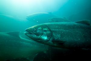
The Scottish fin fish farming industry has stated that it aims to double its value by 2030, which will inevitably mean that more coastal communities will have to address local environmental & employment impact. Although it is widely acknowledged that fin fish farms, particularly salmon farms, result in higher densities of sea lice in the surrounding aquaculture area, there is on-going debate about the respective distribution & cumulative volumes. This project will collate information from a variety of sources to enable coastal communities to map likely sea lice distribution & density, taking into consideration local geology, tides & currents, etc & factoring in the cumulative impact of other fish farms nearby, regardless of operating company. This information will be shared freely via a new website currently under development. The aim is to have a user-friendly resource which communities could customise for their particular area producing an easy to interpret visual map quickly. This grant is towards the costs of creating the basic foundations for this system, based on the successful mapping already produced for the Firth of Clyde & Loch Hourn, with more customisable options anticipated in phase 2.